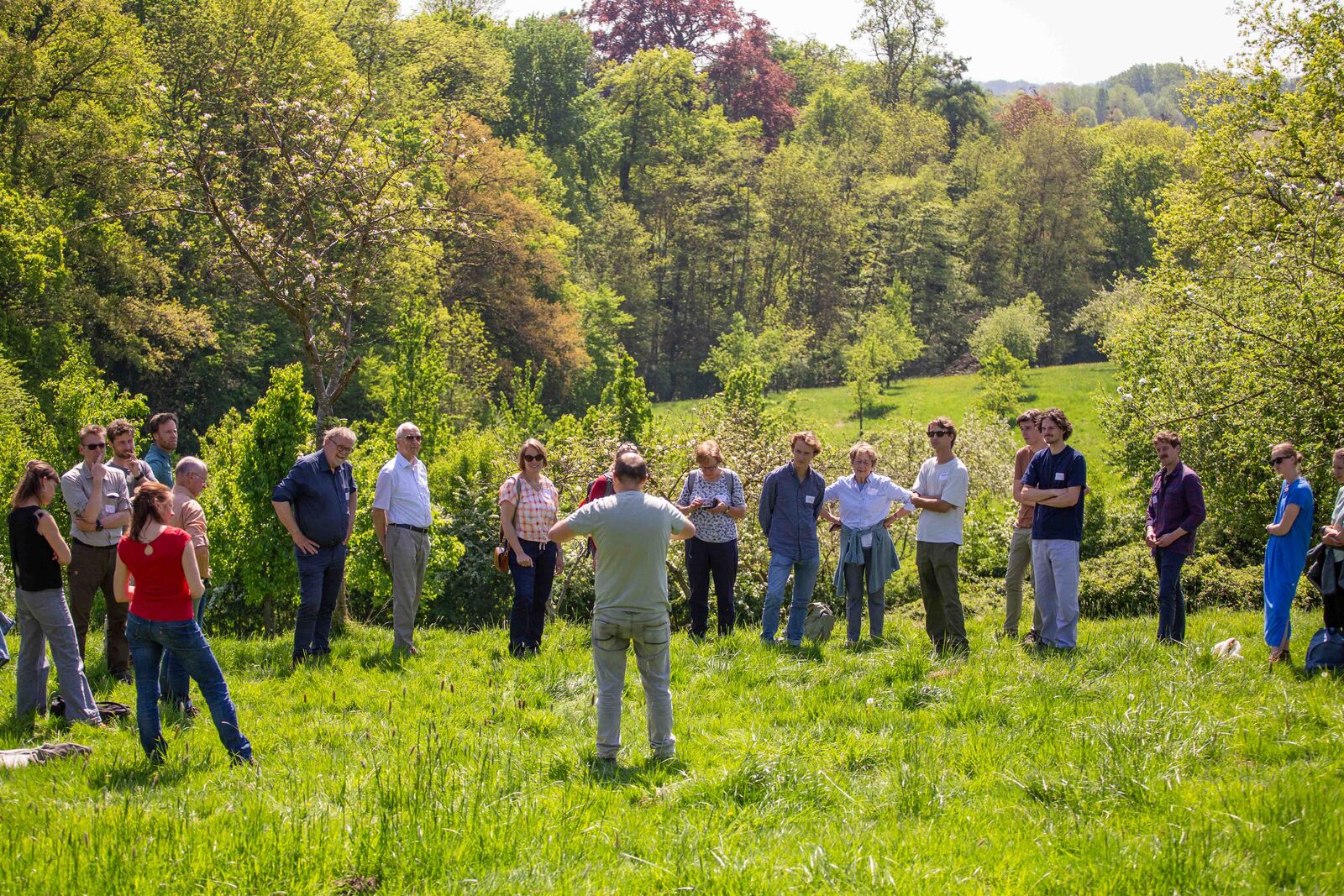
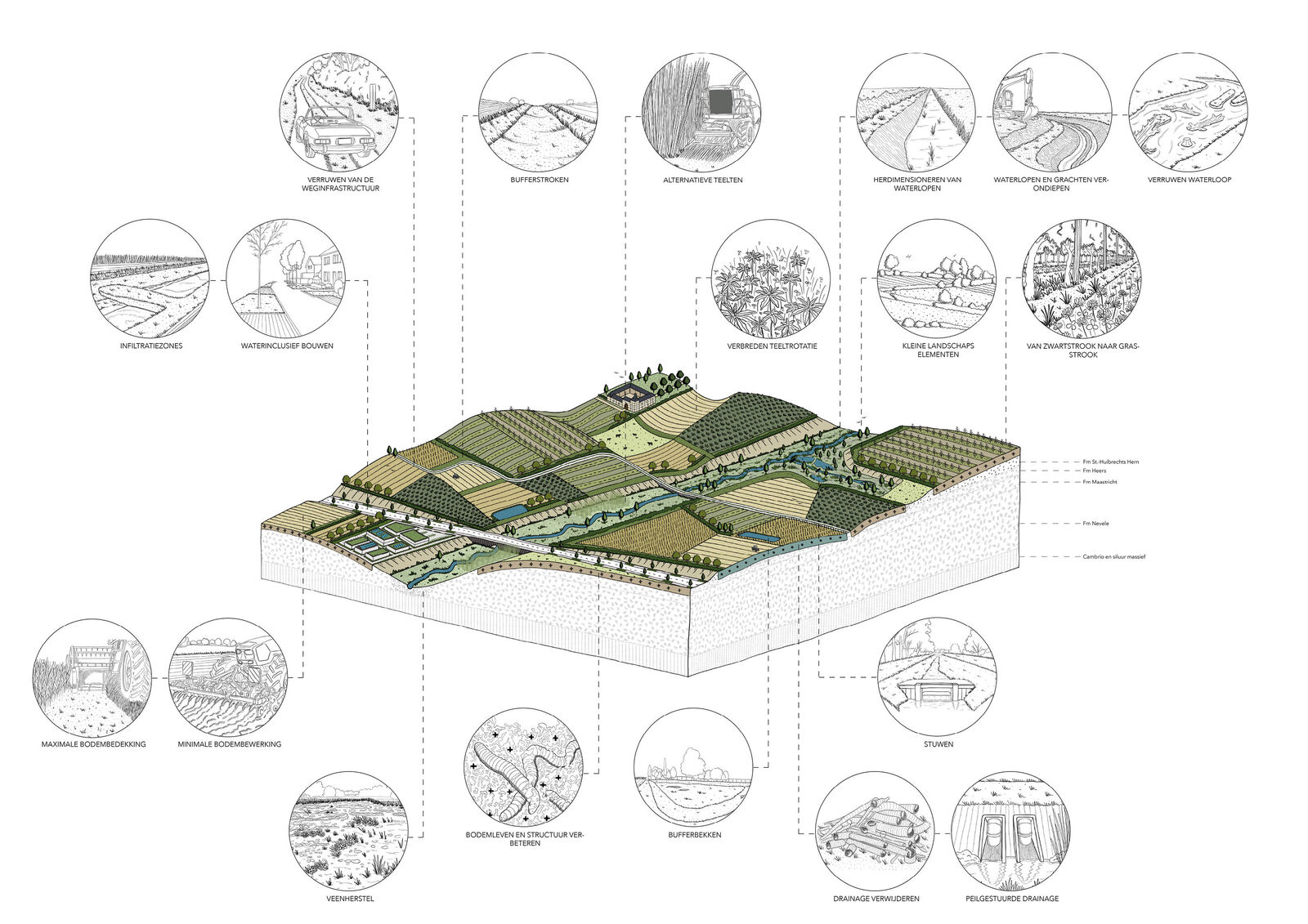
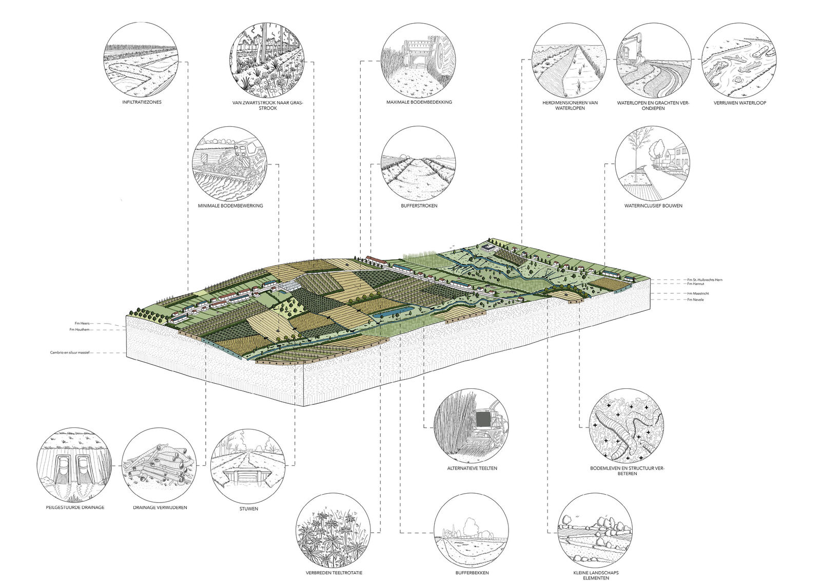
Since 2023, Architecture Workroom Brussels has been managing a living lab in the Herk and Mombeek valley. How can we maximise water retention in the landscape to prevent drought and flooding? How can we achieve this not only in the streams and surrounding nature, but also in the villages, fields, forests and meadows? The devastating floods of 2021 demonstrated just how vulnerable the valley is. Accelerating the implementation of the required sponge measures was vital.


The Herk and Mombeek valley is a sub-basin of the Demer basin and is also called 'the roof of the Demer' due to its upstream location. Heavy rainfall in summer 2021 caused multiple floods in the area – a situation that will be repeated if no further action is taken. Sponge measures are required in lower-lying parts of the valley, as well as on the banks and in higher-lying areas. At the moment, the overly rapid runoff of water results in erosion and increases the risk of flooding. Drought is also adversely impacting the sub-basin. Ponds already dry up in February and both fruit growers and arable farmers on the upstream banks are struggling due to declining crop yields. Out of necessity, they are seeking more profitable alternatives to apple growing, among other things. Orchards are being uprooted and ploughed, which in turn is detrimental to the soil's health.
Basic principle: Resilient Wetland
The natural landscape and water system of the Herk and Mombeek rivers must be restored to cope with the many challenges they face. To this end, the Living Lab can rely on an active regional coalition, led by Regional Landscape Haspengouw & Voeren and the Demer basin operations. They have been working on increasing the landscape's robustness for years as part of the Water+Land+Scape programme.
In the Living Lab, we bring together scientific and practical expertise on source-based measures in natural areas, in agriculture and in urbanised or mixed-use areas. This forms the basis for setting targets for water security, adopting a co-creative approach, which was previously unknown territory. In this process we build on the method proposed in Resilient Wetland: we set area-specific targets based on the damage local site managers consider unacceptable, and confront the site managers with the risks posed by climate change. Design research and impact modelling are our main tools in this process.
Objective: Working together towards a sponge landscape
Achieving consensus within the coalition on what damage is or is not acceptable requires an innovative social process characterised by mutual understanding. The nature sector will not be able to absorb all the water during peak rainfall if it is in poor condition. Not all farmers will have the know-how, machinery or time to maintain their grass strips, which slow down runoff water. Villages should not expect floods to be diverted to open space if public roads accelerate water runoff. There is no shortage of examples. The resilience of a specific area depends on the actions taken in each domain. This is why the interdependence of different actors is key to the Living Lab Herk & Mombeek. We clarify the interrelationships and translate them into cross-sectoral objectives.
Method: What-if scenarios
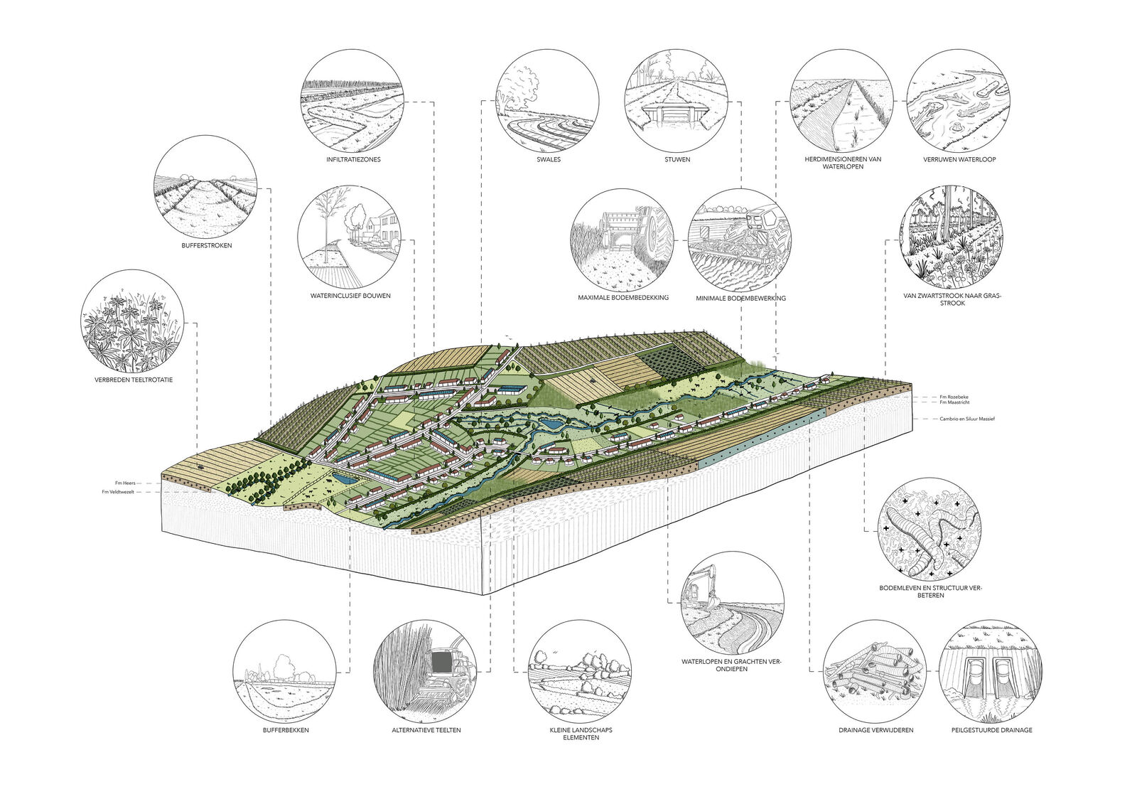
We compare various 'what-if' scenarios to make the coalition's goals tangible. In doing so, we bear in mind their potential (spatial) impact. What if we accelerate tried and tested measures without questioning existing land use? That would only allow us to partially achieve the objectives. What if we use civil engineering measures in existing land use? That would allow us to achieve the objectives but we would need to build additional storm water balancing basins to serve as a buffer for the large amount of rainfall, or reservoirs to irrigate drought-sensitive crops. What if we modify land use based on the physical water system? That would also enable us to achieve the objectives but we would need to strike a balance between the landscape's capacity to retain water on the one hand and the demand for water for crops and ecotopes on the other.
The direction the Living Lab eventually takes will be somewhere in between the extreme scenarios. We are working on a sustainable and area-wide strategy that links the direction (the 'what') to the feasibility of the measures (the 'how'). In a number of focus areas, we are developing a plan based on local knowledge and design research that takes this into account.
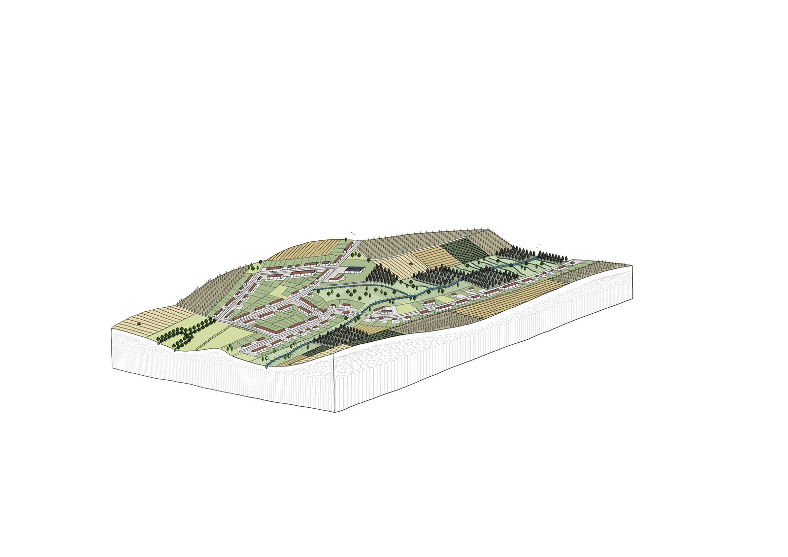
Towards a supported action plan
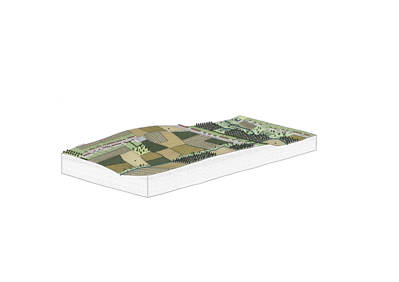
Making the landscape resilient for the future is a step-by-step process. The 2025-2030 action plan (submitted for approval April 2025) collects the to be rolled out actions for the short term, that will have long-term impact. The coalition makes choices: we focus our efforts on a collective approach and priority is given to measures that are good for flooding and drought, but also erosion control and water quality. This action plan also broadens the scope. Besides demo measures with a few individual frontrunners, we are committing to an area-oriented and integrated approach in field labs. A field lab is a demarcated zone (2,000 to 3,000 ha) in which a combination of measures is set up across different sectors and themes – ranging from the watercourse, over the flanks to the plateau. In this way, the cumulative effect of the various interventions can also be monitored.
Context: Four WATER+LAND+SCAPE coalitions
Living Lab Herk & Mombeek is one of four Water+Land+Scape coalitions experimenting with the impact of source-based measures on sub-basins, for which the Flemish Government is providing an initial investment budget of one million euros. The other three areas are the Getestreek, the upper course of the Yser and the area between Kortrijk and Roeselare. The experience acquired during the Living Lab Herk & Mombeek will be applied to the other basins and to Flemish policy. Living Lab Herk & Mombeek's selection as a Water-Oriented Living Lab by Water Europe provides international learning opportunities.

