Open space is vitally important. We need open space to safeguard our food supply and biodiversity. The open space also provides our urban society with many other services. It mitigates the effects of climate change, has a cooling function, offers buffer capacity for water shortages or excesses and is needed to generate renewable energy. What’s more, the open space affords us moments of calm, silence and experiential aspects that serve as an essential counterweight to hectic urban living.
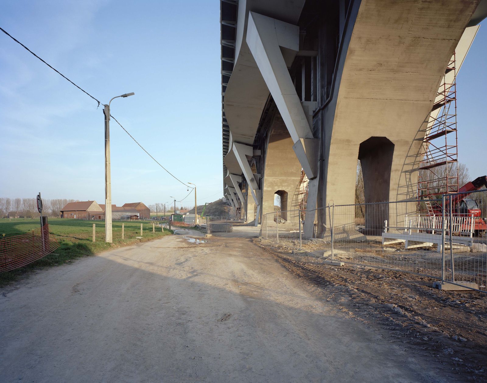
Over the course of the past century, the open space has been under pressure. We are increasingly eroding the open space for additional urbanisation, for living and working, for recreation or infrastructure. Open space has become a scarce commodity. In Flanders, seven hectares (or ten football pitches) of open space disappear every day. Despite the ‘concrete stop’ – or ‘construction shift’ – announced in the Spatial Policy Plan for Flanders, we continue to swiftly devour the open space.
The ugliest country in the world
The realisation that this cannot go on is nothing new. Renaat Braem already pointed it out in his famous pamphlet in 1968. According to Braem, Flanders is the ugliest country in the world, and the cause is its cluttered landscape. It is as if, he writes, a ferocious giant has hurled his box of bricks on to the ground with contempt.
Braem was the first person to identify the issue. Many others followed. Flanders was defined as a ‘dispersed city’ and the phenomenon of the unbridled sprawl and dispersed urbanisation was denounced. In all these attempts to reassert the value of the open space, a different urbanisation model was put forward as the ideal: the compact city in the middle of an open landscape. If we all lived a little closer together, this would free up space for nature and agriculture. The compact city is the key to preserving the open space and sustainable spatial planning.
The DNA of Flanders
But is this a realistic model for Flanders? If we look at a satellite photo of Europe at night, we see a predominantly dark continent with large, concentrated patches of light here and there. These are the metropolises like Paris, London or Madrid. However, two regions stand out: the Eurodelta (roughly the region of Flanders, the Netherlands and North Rhine-Westphalia) and the Veneto region in the north of Italy. Here you see that urbanisation has spread over a vast territory. Converting Flanders, or by extension the Eurodelta, to the model of the compact city would be contrary to its DNA. Should we not assume the distinctive strength of the 'horizontal metropolis'?
In the run-up to the Venice Biennale of 2012 we came to realise that it was necessary to place another model against that of the compact city in the open landscape. We were selected to represent our country in the Belgian pavilion. In The Ambition of the Territory exhibition we presented a new vision and approach for addressing dispersed urbanisation. It was a radical way of not reading the Flemish territory as a cluttered whole that we could reorganise through planning and a new zoning approach, but as a plea to embrace the complexity and sustainably transform the existing spatial system. Instead of judging the endless sprawl as ugly or anything but sustainable, we focused on the hidden qualities and their potential.
Intricate urbanisation
We discovered that the current dispersed urbanisation pattern was not necessarily an outgrowth of the welfare state after the Second World War, as is usually assumed, but that the 'decentralised' or 'polycentric' city has strong historical roots. Flanders and the Eurodelta have matured and owe their prosperity to this intricate urbanisation, with many small towns and centres that have developed on the fertile soils along the extensive river networks.
This new assessment demonstrates that the landscape offers huge potential for horizontal relationships, exchanges and combinations of programmes and functions. The insight formed the starting point for developing the future of Flanders based on possible synergies between functions, and no longer on the ideal image of a strict separation between the city and the countryside.
From research by design to action on the ground
For Architecture Workroom Brussels The Ambition of the Territory marked the beginning of a ten-year work period involving the issue of the open space, in Flanders and the Eurodelta as well as elsewhere in the world. The open space work domain is broad and has many offshoots. It extends to diverse themes such as agriculture, food supply, ecology, soil, water management and climate change.
This narrative is divided into three chapters. In the first chapter we use several key projects to explain how we identified the issue of the open space as an urgent work area. It is also the first phase of our practice: agenda setting, mapping and research, developing and unlocking knowledge and identifying concerned actors and stakeholders.
Knowledge development and agenda setting are one thing, but if we actually want a new future for the open space, it is necessary to visualise the next step for this new future. This is discussed in Chapter two: the application of research by design as the driving force for change. The big challenge involves demonstrating how transformation of the urban and open space system can lead to a better, healthier and prosperous society.
In our practice we have gradually discovered that visualising a future through research by design, however valuable and necessary it may be, is not a silver bullet. Our efforts were often in vain. What was lacking was the step towards implementation and action on the ground, not only as a pilot or demonstration project, but also on a much larger scale. Therefore, in the third chapter we outline how we gradually developed a new method or action plan. Together with our partners we succeeded in rolling out the so-called 'programme operation' for the open space in Flanders and the Eurodelta. This is a method that allows change to be accelerated in the field, to be scaled up and replicated in many places simultaneously.
The projects bundled in this narrative are exemplary but not exhaustive. Neither is Architecture Workroom Brussels the sole author or owner thereof. The basis of our practice is co-production. The projects we describe here inherently came about in close collaboration with other partners, local authorities, civil society organisations, knowledge institutions as well as private actors.
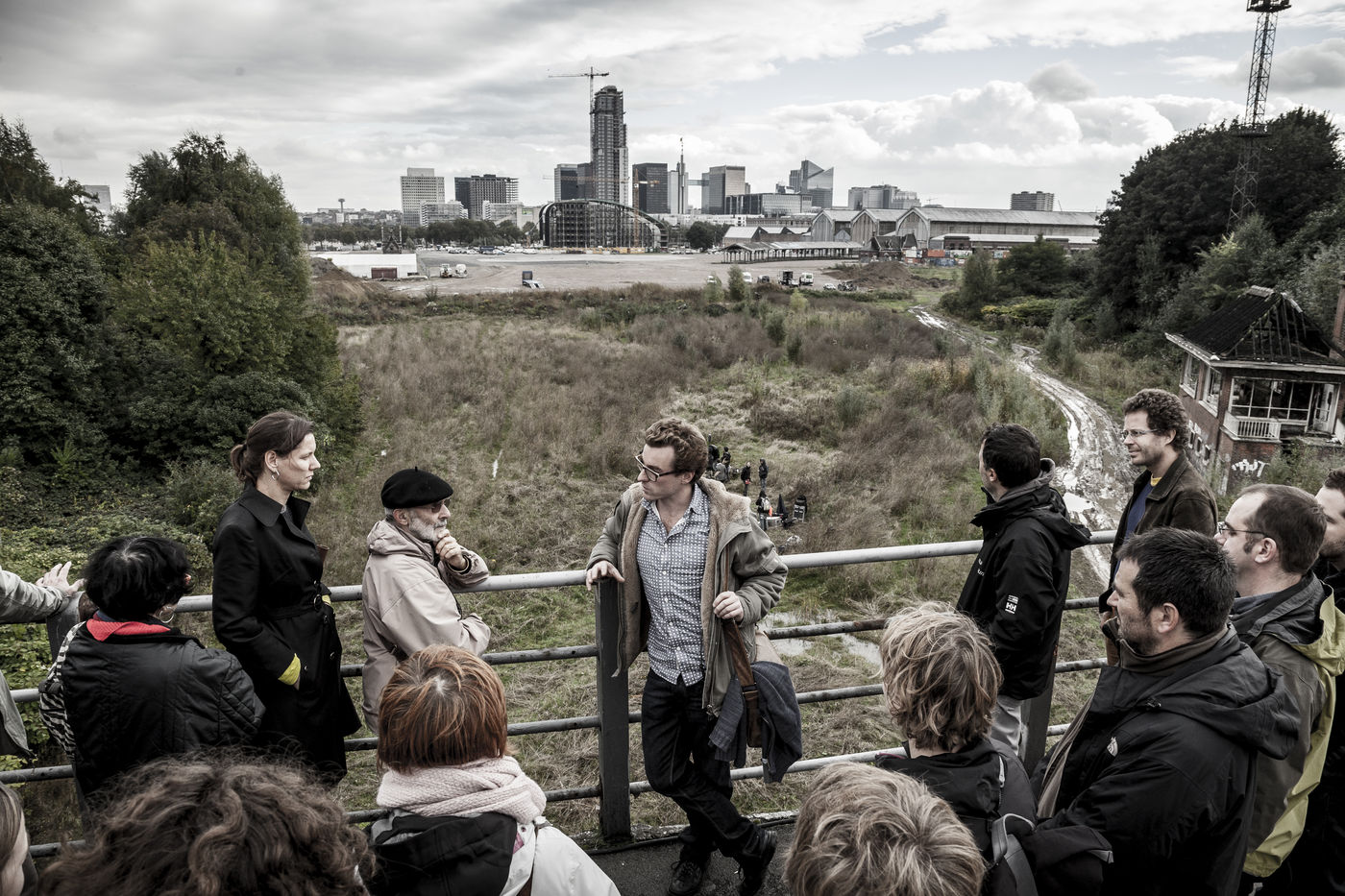
After Venice, The Ambition of the Territory travelled to deSingel in Antwerp. The second edition was much more than just an exhibition. With the new structure as the backdrop we organised an intensive series of lectures, debates and design studios.
During one of the seminars, Griet Celen from the Flemish Land Agency (VLM) spoke with André Loeckx, professor of architecture at KU Leuven and chair of the Urban Policy Committee. André Loeckx explained to Griet Celen: “I have worked for years with Flemish Urban Policy on urban renewal projects. You have already worked for years in urbanised Flanders. How come we have never sat down around the table together?”
The question was telling. For decades, policy for towns and the countryside was separate, as if they were two completely different worlds that each require their own expertise. This has changed in recent years. The boundary between town and countryside increasingly appeared to blur in practice. 'Urban renewal' expanded its field of work to the outskirts of the city and land parcelling in the suburbs, while 'land use planning' increasingly extended to urbanised areas.
Pivotal moment
The debate in deSingel was a pivotal moment, in which we, together with our partners, put our weight behind creating support for a sustainable approach to the open space. The seminar ended with a call for a regional-oriented and integrated policy that considered the city, landscape and territory as a single spatial, societal and social system. A system in which open space and urbanisation no longer competed but were mutually reinforcing.
And so the seeds of a new vision were sown. Open space and urbanisation are essential components of one large, cohesive metabolism. We must ensure that the open space is no longer threatened by encroaching urbanisation, but that it jointly provides direction to the urban environment. Therefore, the logic is reversed. Open space now serves a steering function for urban development, instead of vice versa. The open space is going on the offensive.
In 2013, the Flemish Land Agency (VLM) celebrated its twenty-fifth anniversary. On this occasion, together with the architectural firm Bovenbouw, we examined what the blurred boundary between town and countryside could mean for the agency's future. Based on an introspective reflection on the operations of the VLM, we outlined six future scenarios in which the open space is not under pressure from urbanisation, but jointly steers it. We visualised these future scenarios in six ‘tableaux’. Each one raises an issue that inspires the development of new programmes and projects. They call for cooperation and for a sectoral approach to the open space to be transcended. The Open Space Offensive was the beginning of an ongoing collaboration with the VLM, which has lasted for years, in which we not only elaborated our insights in theory but also in terms of implementation on the ground.
The outskirts of the city represent a crucial work domain for an ‘open space offensive’. It is where the pressure on the open space is often greatest. On the Contested Lands map we mapped out the region around Brussels. The metropolitan region of Brussels is one of the most densely populated areas in Europe, with a total of four million people and a density of 820 inhabitants/km2. The map shows an amorphous pattern of urbanisation interwoven with snippets of open space and agricultural land. Due to encroaching urbanisation in the conurbations around Brussels farmers are pushed further and further away. The fragmented agricultural areas are no longer suitable for a large-scale farming model aimed at exports. Agricultural land is increasingly ending up on the residential real estate market, causing prices to rocket. Local food production is put at risk and thus also biodiversity, space for water, ventilation and cooling for the city, and options for recreation. In short, the health of this urban area is at stake.
Dispersed urbanisation also offers opportunities. The interface between urbanisation and open space is up to seven times greater in Brussels than in compact Paris. The proximity between our living environment and small areas of open and green space is an opportunity to bring locally produced food closer to the consumer. It creates possibilities for integrating an alternative agricultural model, for which proximity to the city is an asset instead of a handicap.
Compared with other European cities, the open space in Brussels is larger in terms of surface area and nearer, but it is highly fragmented, inaccessible and often even invisible. The photo reportage by Tim Van de Velde provides an impressive view of the open and green space in and around Brussels. Tim Van de Velde produced the reportage in relation to the Atelier In Between. This is a preliminary policy process in which we led an inter-regional dialogue between diverse actors, civil society organisations, sectors and policy managers that have an impact on the open space in the Brussels metropolitan area. The choices made in each sector and at each competence level (regional, provincial, municipal) are forced to come together in the same space. Therefore, a cross-sectoral and integrated approach is needed. This applies all the more in the complex administrative context of Brussels and Belgium. With a shared vision and integral policy we can steer in the direction of a new future for the open space, in a more vigorous, transparent and efficient manner. We could add up and merge the many green residual spaces to produce a strong, cohesive open space system. The Atelier In Between laid the foundations for the Metropolitan Landscapes study.
If we want to take the agriculture that still remains in these snippets of open space seriously as an important local food producer and landscape manager, we must dare to question current urbanisation processes. In Urbanising in Place we examine the possibilities of ‘agroecological urban planning’. This is an alternative organisational form for the city that makes sustainable food production possible once more. We do this in a diverse international collaboration with the founders of the agroecological programme of Rosario (ARG), sociologists from Wageningen University & Research (NL), urban designers from Ghent University (BE), architects from Riga (Latvia), land activists from London and the agroecology lab in Coventry (UK).
The action study in Brussels strived to build a bridge between the remaining farmers in the Pajottenland and the upcoming movement of young urban farmers, spearheaded by BoerenBruxselPaysans. In dialogue with these actors we outlined the building bricks for a Brussels metropolis that makes room and provides support for nature and socially inclusive food production and distribution. The international exchange inspired the government of the Brussels-Capital Region to include the foundation of a 'centre for urban agroecology' in the coalition agreement for the current parliamentary term.
If we want to create broad support for boosting the open space, the acquisition and dissemination of knowledge and insights alone does not suffice. We also need to try and form an appealing picture of this new future. This is why we combine our projects with research by design as a driving force for change.
In this case we find ourselves on relatively unknown territory. Architects and urban planners may well be familiar with research by design in inner city areas or in rural areas, but in places where urbanisation and the countryside converge new expertise and a new conceptual framework are necessary. What constitutes an ‘urban food landscape’ or a ‘water landscape’? How can we achieve a new balance between the urban system and the open space system? How can we shape both as a single cohesive metabolism? Which specific projects connect the different social services provided by the open space?
Climate change
In addition, over the past decade, a new theme has featured prominently on the agenda. A broad awareness has grown of climate change as one of the most threatening global developments for the next century. Climate change makes the transformation of our open space system urgent and necessary. The open space is the ultimate buffer that we can use to absorb and temper the consequences and effects of climate change. The open space is the key to making the territory more climate resilient, not only in Flanders but also in the Eurodelta and elsewhere in the world.
We were able to draw a great many lessons from the research by design. First of all, the complex mutual dependence between the city and the land came to light. The various social and spatial challenges and ambitions related to the climate, water systems, agriculture, forestry, industry, biodiversity development or housing construction are closely interwoven. This demands complex system thinking in which different areas of expertise will have to identify with one another and learn to speak a common language. It also means that extremely diverse stakeholders are involved: authorities at different levels, landowners, farmers, soil carers, civil society organisations, nature associations, water managers and so on.
At the same time we also unearthed the shortcomings of research by design. An appealing future vision cannot in itself initiate change. What we also need is a restructuring of policy and a search for new funding models.
What if the urban system radically bowed to the open space system? We tested this in 2012 on the occasion of the IABR 2012–MAKING CITY. We started work in Arnavutköy, the region slightly to the west of Istanbul. It is a region of great ecological value due to its many drinking water basins, forests and agricultural areas. Since the Nineties, this valuable region has been under threat from explosive population growth of at least 400%. Former mayor Erdogan launched ambitious plans to transform Arnavutköy into an important city centre on the European side of Istanbul. The region has to cope with the challenge of reconciling the planned growth with ecological values.
As Atelier master we invited the Brussels architectural firm 51N4E and the Dutch landscape architects from H+N+S to conduct research by design into the area together with a team of local experts. The designers produced two maps with, on the one hand, a scenario in which the current status quo is maintained, and on the other one in which there is the desired urban development. In the first scenario all ecologically valuable areas risked being swallowed up by the proliferation of urbanisation. The lakes disappear, which means Istanbul's water supply is threatened and the risk of flooding and pollution increases. The second map shows an alternative scenario: compact urban fabric with the natural landscape at its core. The scenario affords space for water in the low-lying areas, while a compact city retreats to the hilltops. In between, like a buffer between the city and nature, you find agricultural land parcels.
In the IABR–Atelier Brabantstad, during the sixth edition of the IABR 2014–URBAN BY NATURE, we conducted research by design in association with Lola Landscape architects and the architect Floris Alkemade into what Brabant locals rather aptly call the ‘mosaic metropolis’. In contrast to the usual planning logic we proposed not to concentrate spatial development in and around the five city centres. We took a different approach and explored how we could reorganise the widely dispersed urban landscape to produce a single cohesive system in which challenges and opportunities in the city centre are linked to the challenges in the outskirts.
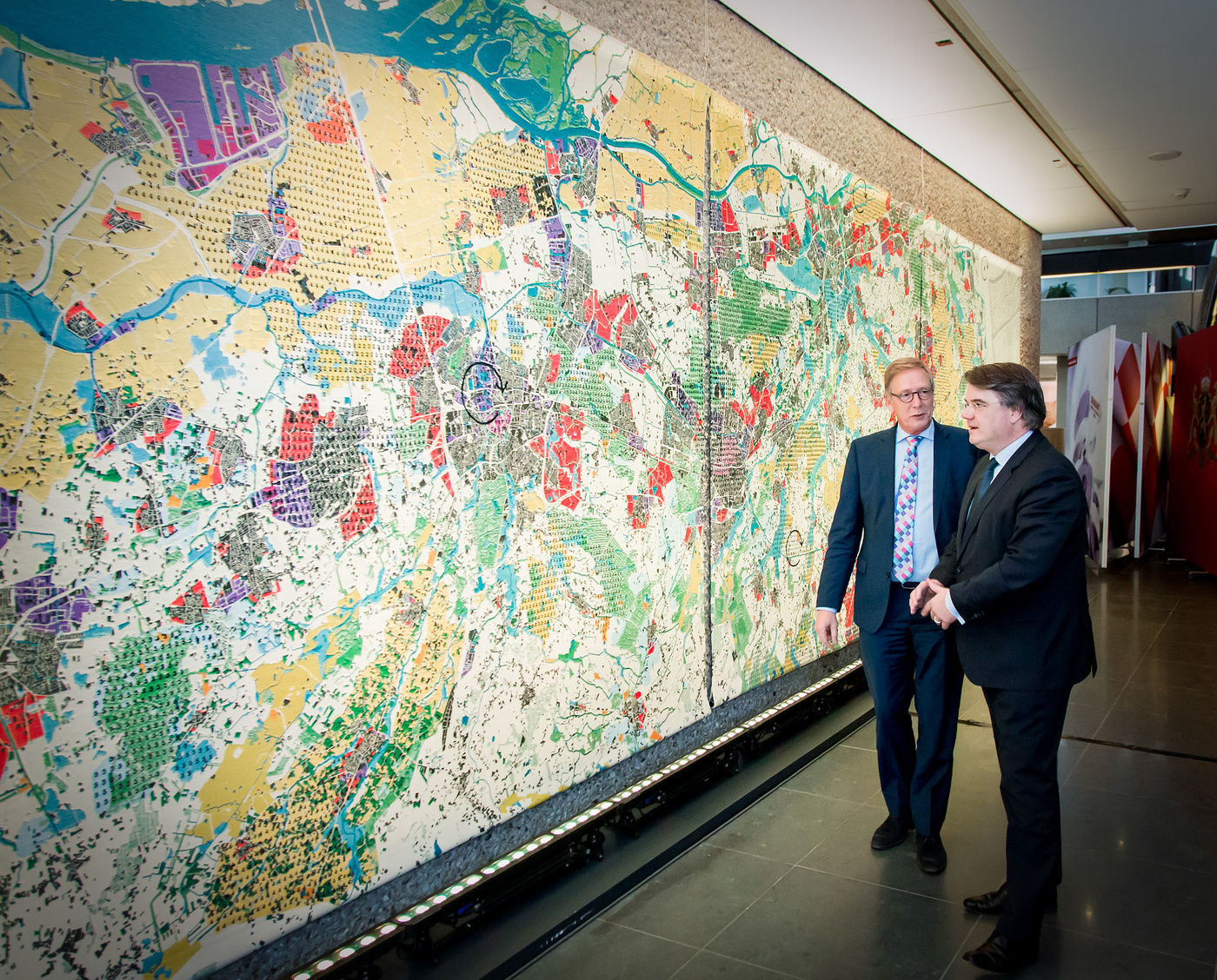
One of the outcomes of the research by design was an alternative map of Noord-Brabant, which we literally wove like a tapestry, twelve by three metres. The carpet was first displayed at the IABR, and subsequently travelled through Brabant. The map shows a mishmash of intersecting patterns. It is not a classic destination map, but a map that defines 'recurring problems' or 'types of challenges' using a numerical code. The challenges are diverse and concern matters such as agriculture, forestry, water issues or industry. Identifying these kinds of links as recurring challenges offers the possibility of simultaneously initiating action in several places. This approach enables us to accelerate and multiply the desired action on the ground.
In the research by design for Metropolitan Coastal Landscape 2100 about the future of the Belgian coast, we strived to reverse the usual development logic, just like in Istanbul: what would it mean if the urban system adapted to afford space for water once more in a natural landscape? We drew up four future scenarios, of which the 'Double pole variant' may well be the most striking or controversial. According to this scenario the western half of the coast is largely returned to nature. During spring tide, storm surge or flooding from inland, large areas such as the IJzervlakte can flood. Veurne, Nieuwpoort or De Panne are still on the map, but are surrounded by water or marshland. This creates a landscape that is similar to the bay of the Somme in Northern France, offering space for nature and water tourism. In this scenario the eastern cluster around Ostend to Knokke and Bruges would be protected against rising sea levels and form one large, urban region.
The double pole scenario appeared in the newspapers even before the project had been completed. It caused quite a commotion. The result of the research by design was presented as a future plan that was going to be implemented. Of course, this was never the intention. The four future scenarios showed four extremes, allowing radical thinking which, in a later phase, around the discussion table, would evolve to reach common ground. Due to the publication of a single scenario the coastal mayors had no choice but to publicly distance themselves. As a result it became extremely difficult to shift towards a common denominator in the follow-up project.
Years later the image of the double pole was picked up by the producers of the Flemish-Dutch fictional series Als de Dijken Breken (If the dikes fail).The map appeared in the background as the desired future scenario after the outbreak of a new flood at the coast.
This anecdote teaches us that radical scenarios in themselves are not able to initiate change. The vision of the future is quickly dismissed as ‘fiction’. Research by design does not suffice on its own. We learned that designers should not only design, but that we should also challenge them to jointly shape processes. Not only the conception of the end result, but also how we achieve it, is a task for the design process.
Conserving the open space is not only the job of the authorities. Management of this collective good lies in the hands of a diverse group of open space caretakers, first and foremost farmers. Today, half of the open space in Flanders is allocated for agricultural production. Therefore, farmers are undeniably important stakeholders
In the Productive Landscape pilot projects, an initiative by the Flemish Government Architect and the Institute for Agricultural, Fisheries and Food Research (ILVO), for the first time farmers were given a voice, resources and a mandate to experiment with enhancing the open space. We were involved in both the preparatory and concluding work. We mapped out the problems and defined five urgent areas of work to which farmers, local authorities, businesses and landowners could subscribe. Each of the pilot projects was assigned a designer and an area director.
Not all the pilot projects were implemented. It soon became clear that the problems in the agricultural sector were more than purely design issues, and that fundamental policy changes were also needed. At the end of the pilot projects we were asked to bundle the main lessons learned. Together with the steering group we wrote a manifesto containing five urgent policy recommendations. One of the most significant conclusions of the project is that for the transformation of agriculture and the open space we not only need designers, but also ‘area directors’ or ‘food directors’. These are multidisciplinary experts that bring all the diverse actors around the table and build a bridge between policy, agriculture, citizens, ecology, climate, water management, soil care and urban development.
Water is one of the most complex challenges, not only in Flanders, but all over the world, not least because water issues such as flooding, drought, pollution or salinization are often closely related to other global issues such as climate change, migration, population growth, pressure from urbanisation or the rising demand for food and energy.
If you look at the World at Risk map you see that the most densely populated places on earth (red) are also the places where water represents a major threat (blue). This is not surprising. Since time immemorial, people have settled in the fertile delta regions, where water is abundant and rich sediments provide fertile soil. The coastal and delta regions in Asia are predominantly red and blue. There is nowhere else in the world where water-related disasters are so widespread and costly as in Asia, where 83% of the population may be affected by flooding, the rise in sea level or overdrafting. However, it is precisely because water issues are closely linked to major global challenges that water is not only a problem, but also the key to finding a solution.
Design proposals that view water as a lever for urbanisation, could also be the solution to the difficulty of obtaining funding for water projects. This is the hypothesis tested by Water as Leverage for Resilient Cities: how can we use the water issue as a lever for the sustainable, integrated and fundable urban transformation of Asian coastal and delta cities?
In order to test this approach in the field, we set up a partnership with the Netherlands’ Water Ambassador, the Asian Infrastructure Investment Bank (AIIB) and three Asian metropolises: Chennai in India, Khulna in Bangladesh and Semarang in Indonesia. Together with the three cities we documented specific local issues. On this basis, in 2018, we launched a call for consortia of designers, engineers and advisers. The intensive design process that resulted, produced a number of innovative and transformative project proposals.
WaL harbours high ambitions: to implement integrated, fundable and locally-supported projects that proactively focus on climate change. This ambition still appeared to be too great for the strict procedures applied by international investment banks. Moreover, there was insufficient time to adequately develop local capacity building. Nevertheless, the power of the imagination and the innovative process of WaL, have set in motion an important cultural change by, for example, involving financiers at the beginning of the design process. As of 2020, we are involved once more in WaL_REFLECT, a partnership with the Netherlands’ Water Ambassador, the OECD and the University of Groningen. In this process we aim to convert innovation at the social, financial and design-oriented level into a structural partnership able to achieve ambitious implementation programmes. We are moving from research by design to change on the ground.
The challenges related to agriculture, water, energy and the environment are closely interwoven, but our structures and our policy are not organised accordingly. Too many studies and too much research by design involving the future of our living environment end up shelved and hardly any are implemented. However, if everything is interwoven it can also be organised to reflect this situation. The underlying dependence of challenges and ambitions is not a threat, but an opportunity for bundling resources and knowledge and increasing our impact. This requires a new method and new ways of collaborating. We must take the step from research by design to action on the ground: the step from dreaming to action.
In the Operation Open Space publication for the first time we outline a new, active and integrated approach to the open space in Flanders. We make a plea for a ‘programme operation’, a method for tackling urgent issues on a large scale, as a multitude of smaller, bite-size projects. A programme operation identifies ‘recurring’ or very similar problems that occur in many different places in Flanders. Per ‘family of challenges’ we forge coalitions of services from the Flemish government, local authorities and private actors.
Thanks to the programme operation we dispense with the one-off nature of the pilot project. It is a lever to achieve accelerated implementation and the necessary multiplication of concrete projects in the field. The first test was the Water+Land+Scape programme: lots of small-scale projects jointly make up one large one.
Due to climate change we are increasingly confronted with flooding and long periods of drought in Flanders. Agriculture is already suffering considerably as a result. Action on the ground is desperately needed. Therefore, in 2017, partners of the Open Space Platform launched a call for the Water+Land+Scape programme. The programme aims to identify urgent needs related to water management in agricultural areas and find suitable solutions together with farmers, water managers, landowners, nature associations and local authorities, which involve a win-win situation for healthy agriculture, a sustainable water system and a robust landscape.
The call resulted in over forty proposals for initiatives to address very specific, water-related problems, from which fourteen projects were selected. The Flemish government allocated a budget of 818,500 euro for the first series of demonstration projects. The subsidies allow local partners to test new solutions for water management in a changing climate with farmers and landowners. Work will begin in 2020. Some of the projects will run for ten years.
The Water+Land+Scape programme aspires to accelerate and multiply specific achievements in the field. This is done by taking action at different locations simultaneously, learning during the process and continuously exchanging knowledge. The fourteen coalitions are not separate projects that operate independently. The intention is that each of the projects can learn from what happens in the other projects, and that the knowledge acquired is made accessible. Future coalitions can build on this. The fourteen demonstration projects represent the seeds of a much broader multiplication across the Flemish territory as a whole.
The programme operation method relies on support, and is also successful when it arises from an urgent social need. Flanders is one of the frontrunners of hard surfacing in Europe. The demand for unsealing increasingly crops up in ever more places in Flanders. Local momentum has built to remove hard surfacing, abandon housing expansion areas, combat heat island effects or tackle water infiltration problems differently.
Support for unsealing was first widely endorsed at the Unsealing forum we jointly organised in 2018 with the Department for the Environment. In September 2018 and April 2019, there followed two calls that were supported by an intensive guidance trajectory, focusing on process and design-based support, communication and participation, as well as legal and financial support. In this trajectory AWB served as process supervisor and the party that recorded the lessons learned. The objective is twofold: on the one hand we aim to achieve effective and systematic unsealing in a number of places in Flanders, on the other we want to learn from these unsealing practices and apply the knowledge acquired in other places and with other partners.
During the project we bundled the lessons learned in a workbook. It became clear that unsealing involves much more than literally removing the hard surfaces or demolishing the built-up space. Unsealing is an action that creates conditions for addressing several problems at the same time, such as water infiltration, heat stress, biodiversity or healthy soil. Unsealing stimulates a cross-sectoral approach, creates new design challenges and requires the development of a new practice.
We tested the new 'programme operation' method with different partners in various contexts. The Water+Land+Scapeprogramme taught us how to create a neutral context to ensure a hydraulic engineer from the Flemish government that models flood plains in 2050 and a farmer that struggles with drought issues today not only understand each other, but are also on the same page. Water as Leverage demonstrates that not only can we rely on public resources, but we also have to obtain private and international funds by developing the right business cases. The Unsealing projects on their side, made it clear that the bottleneck not only results from a lack of resources, but at times from a lack of legal or technical expertise.
We also formed new coalitions in relation to other integrated open space themes, especially in the context of the Open Space Platform, co-founded with the Flemish Land Agency (VLM), the Department for the Environment, the Association of Flemish Provinces (VVP) and the Association of Flemish Cities and Municipalities (VVSG). Meanwhile, the Food+Land+Scape, Land Matters (Grondzaken), Sanctuary Oases (Luwte-Oases), Cleaning up the Open Space(Op(en)ruimen), Landscape parks and Drought experimental gardens programmes were initiated. Programme teams were compiled for all these programmes that each work on the alignment and integration of diverse policy objectives, instruments and knowledge to support initiatives on the ground. The publication Open Space Works casts a constructive look back at the experience gained and a critical look to the future on programme operation as a method for the open space in the coming years. In this sense the Open Space Platform is an experiment for a new culture of working, which does not focus on what can already be achieved, but strives to make what we need possible.
Onwards and upwards for Open Space Works!