To fit The Great Transformation into our available territory, we need new approaches with new instruments (or better: new interpretations of existing instruments). Together with and thanks to many partners, AW gradually developed a "programmatic approach" that allows national and regional goals to be achieved at local level in new coalitions (Declerck, J., 2018). We place a third method between generic and area-specific policy: by stacking different map layers on top of each other, we recognize promising combinations that we classify into "families of challenges". The projects and strategies for those similar places can be designed together. Instead of the large regional project we aim for smaller, manageable and common projects that can be realized in a new implementation mode between government and local coalitions.
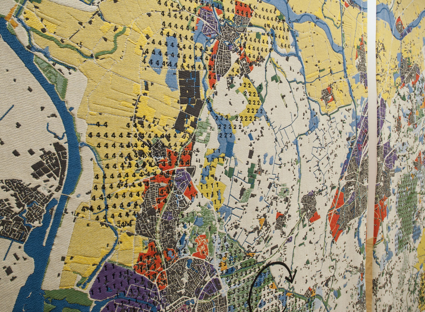
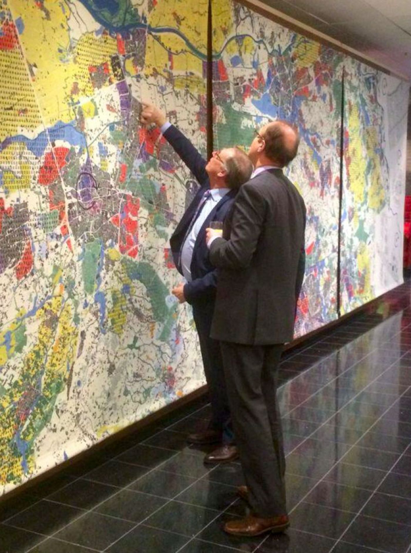
The principle of accumulated map layers was worked out for the first time in "The Ambition of the Territory", a study by the coalition AWJGGRAUaDVVTAT that filled the Belgian pavilion at the Architecture Biennale in Venice in 2012. The cartography that was developed for this purpose, outlined an alternative to the traditional zoning plans that try to delineate different forms of use and the interest groups associated with them sectorally. One plot, one function, one colour. The complexity of our territory was represented in this new cartography instead by a superposition of different overlapping map layers, which made the interactions and conflicts between different users and activities legible. The next step in this discourse was made in Atelier BrabantStad in 2014: the translation of regional cartography into integrated sub-projects or “machines”. The Noord-Brabant region with its colourful mosaic of urban areas, intensive agriculture, avenues, villages, industrial activities, river valleys, nature reserves and canals should be viewed as an urban carpet. The result of the research was a multi-coloured regional mapping, symbolically executed for the occasion on a twelve by three meter large tapestry. This map worked as a foundation for six “machines”: combinations of tasks, with real actors and concrete situations, that are recognizable at different places in the region and that integrate challenges and opportunities related to quality of living, water management and innovative entrepreneurship. For example, by redeveloping outdated industrial areas around collective water storage and purification systems, we combat heat stress in residential areas and we create a healthy urban environment for new economies, where purified water can be used against desiccation, in the canal system or for industrial purposes. This is how problem situations become opportunities. A third project then demonstrates how this approach leads to a structural multiplication of implementation in the field. The Open Space Movement bundles the objectives of different policy domains and depicts them spatially, showing where cooperation is possible. Via a call, local coalitions can be found that are already engaged in linking these goals on the ground. For example, a first program "Water-Land-Schap" was launched in 2017. The Minister of Environment, Nature and Agriculture set aside five million Euro for the joint support of fourteen comparable projects. The government doesn't just grant a subsidy, but it learns to collaborate better between policy branches and with various stakeholders in society. And although not all submitted proposals can be honoured and supported individually, they remain involved in a learning environment, so that not just 14, but 40 initiatives can surf along with the government investment.